

On August 3, 2020, a news conference was held at the State Council Information Office, for announcing that the BDS-3 was formally commissioned. Ran Chengqi, Director General of China Satellite Navigation Office and the spokesperson of the BeiDou Navigation Satellite System, made the introduction. The details are as follows:

Ladies and gentlemen, and friends from the media,
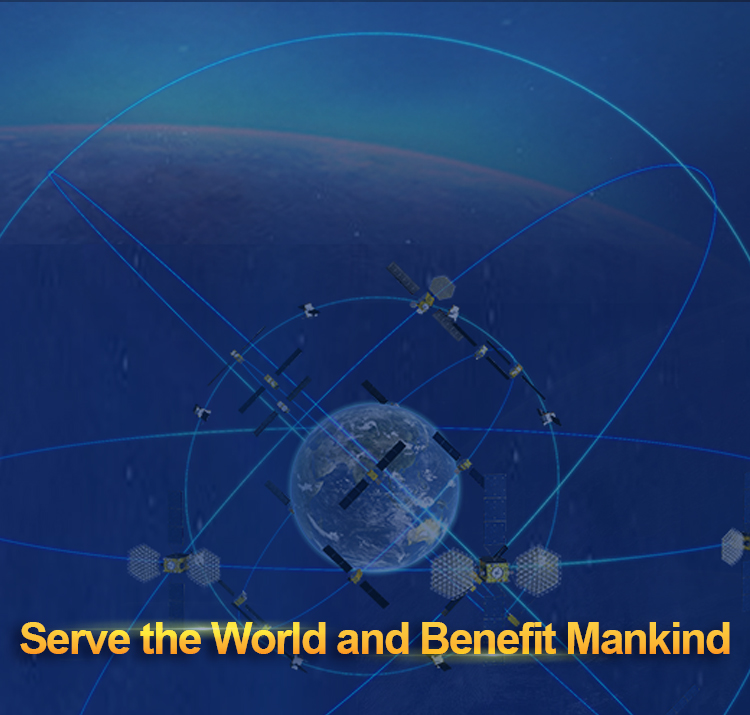
Good morning. It gives me great pleasure to attend today's press conference with three of my colleagues. On July 31st, General Secretary XI Jinping of the CPC Central Committee announced to the world that BDS-3 was formally commissioned, marking the completion of the “three-step” BDS development strategy, and a new era for BDS to serve the world and benefit mankind. Now, I would like to elaborate from four aspects.
I. The system construction is completed six months ahead of schedule, which represents the Chinese speed
The BDS construction has been completed by overcoming one difficulty after another. Initiated in November 2009, the BDS-3 project has gone through five stages, including key technologies breakthroughs, experimental satellites engineering, the minimum system, the preliminary system and the completed system. Presently, BDS-3 has completed the global constellation deployment six months ahead of schedule, and with the start of all kinds of the services. The system is commissioned as soon as it is built, while the services are available right away.
Firstly, independently controllable. breakthroughs have been made in key core technologies, More than 400 agencies and 300,000 research personnel and technicians have gathered their wisdom, to make advancement in more than 160 key core technologies, such as inter-satellite links and high-precision atomic clocks, while more than 500 kinds of equipment components have been made in China, and the domestic production rate of the BDS-3 satellite key components has been 100%.
Secondly, a full play to the advantages of a nationwide system was given to accomplish the constellation deployment with high efficiency. A centralized and unified management were strengthened, a strong engineering and management leadership was built, and a research and development system based on the architecture, technique, quality and schedule was innovated. As the result, the manufacturing cycle of a single satellite has been shortened by a quarter, the assembly cycle of a launch vehicle has been shortened by a third, and the commissioning cycle of a satellite has been shortened by three quarters. A risk analysis and control guarantee chain has been formed, to ensure launch without any hidden problems or dangers. Since November 2017, 30 BDS-3 satellites were launched with 18 carrier rockets in two and a half years, more than 40 ground stations were built, and the satellite-ground integrated operation capabilities were rapidly formed. In particular, in the face of the impact of COVID-19 and the quality risks in the space sector since the beginning of this year, the project management has paid close attentions to the task organization and implementation, the product quality control, and the risk prevention and control, which has achieved overwhelming victories in both the constellation deployment and the prevention and control against the epidemic.
II. The powerful service and the first-class performance represent the Chinese quality
BDS has been pursuing excellence to reach first-class. With objectives being set in comparison with international standards, through iterative upgrades and improvements, the BDS performance indicators have reached the first-class level.
Firstly, the system possesses powerful functionalities. BDS-3 is equipped with two major functions, namely navigation and positioning, as well as data communication. As a powerful global navigation satellite system, BDS can provide seven types of services, including positioning, navigation and timing, global short message communication, regional short message communication, international search and rescue, satellite-based augmentation, ground-based augmentation, and precise point positioning.
Secondly, its performance indicators are advanced. The global positioning accuracy is better than 10m, the velocity measurement accuracy is better than 0.2 m/s, timing accuracy is better than 20 nanoseconds, service availability is better than 99%, while the performance in the Asia-Pacific region is better. Here, I would like to show you a picture and elaborate from three aspects: First, the BDS global service availability. The chart below shows the system status in 2018 when the BDS-3 primary system was just completed. It can be seen that the BDS global service availability was 95%, with dark color marking areas with lower service availability. The chart above shows the situation in 2020 after the completion of system construction. It can be seen that the BDS global service availability is above 99%, without any dark color area. Second, the BDS satellite skyplots at some representative areas across the globe. The red dots in the picture represent the observed BDS satellites. It can be seen an obvious increase in the current number of observed satellites at each representative area, in comparison with that of two years ago. Third, the BDS positioning accuracy. According to the analysis results of IGMAS (International GNSS Monitoring and Assessment System) on the data of last week, the actual measured average global positioning accuracy of BDS is 2.34m. The short message communication service has been upgraded, with a regional communication capability of 14,000 bits (1,000 Chinese characters) per time, which can transmit text, voice and pictures, while the global communication capability is 560 bits (40 Chinese characters). The space-based augmentation services fill the blank in the BDS capacity with the APV-I capability. With the successful probe rate better than 99% and the characteristic ability of the return link, the international search and rescue service can significantly enhance the survival confidence of people in distress. In addition, the ground-based augmentation and the precision point positioning can also provide positioning services up to centimeter level.
Today, in addition to the relevant documents released earlier, we will release another five interface control documents, namely positioning and timing (B2b signal), satellite-based augmentation service (BDSBAS-B1C signal), ground-based augmentation service, precision point positioning service (PPP-B2b signal) and international search and rescue service. All documents are available on the BDS official website. The interface control documents for regional short message communication service and global short message communication service will be issued to designated parties. So far, the issued BDS interface control documents have covered all 7 types of services.
III. The remarkable and fruitful comprehensive benefits represent the Chinese wisdom
Firstly, BDS is a flagship project that serves the nation and its people. BDS has provided comprehensive services for transportation, public security, disaster relief and reduction, agriculture, forestry, animal husbandry and fishery, urban governance and other industries. BDS has been integrated into essential national infrastructure such as electricity, finance and communications. The 28nm-category chips have been in mass production, while the 22nm-category chips will be in mass production soon. Most of the smartphones sold in the domestic market support the BDS positioning function, and smartphones supporting high-precision applications have been launched. A complete industrial chain has taken shape, covering chips, modules, boards, terminals and services. Over the past decade, the general output value of China's satellite navigation and location-based service industry has seen an average annual growth of more than 20%, reaching 345 billion yuan in 2019 and is expected to exceed 400 billion yuan in 2020. BDS has been applied in the transportation along the China-Europe Express Railway, the construction and operation of the high-speed train between Beijing and Zhangjiakou, as well as civil aviation. High-precision applications based on the BDS services have played a positive role in fighting against COVID-19 and the flood in southern China. BDS is also quickly joining new infrastructure development, through the deep integration with the next-generation communications, block chain, internet of things, artificial intelligence. New BDS-based applications, business forms and economic sectors are emerging.
Secondly, BDS is China’s public good for the world. As one of the four global navigation satellite systems recognized by the United Nations, BDS continuously improves compatibility and interoperability with the navigation systems from United States, Russia and the European Union. BDS has been ratified by a number of international organizations, including the International Civil Aviation Organization (ICAO), the International Maritime Organization (IMO), the International Mobile Communications Partnership Project, COSPAS/SARSAT and other international organization standardization bodies. Plenty of international standards have been stipulated to support BDS. The China-Arab States BDS Cooperation Forum and the China-Central Asia BDS Cooperation Forum were successfully held. The first overseas BDS Center was built in Tunisia, and a ground-based augmentation network project in Algeria has been constructed. At the ninth Ministerial Meeting of the China-Arab States Cooperation Forum, China and Arab States agreed to continue in-depth cooperation. At present, the BDS-related products have been exported to more than 120 countries and regions, serving hundreds of millions of users. The BDS-based services have been successfully applied in land mapping, precision agriculture, and digital construction in ASEAN, South Asia, Eastern Europe, West Asia and Africa.
IV. A comprehensive positioning, navigation and timing system, representing another Chinese innovation, will be established
By adhering to the development concept of "China's BDS, world’s BDS, first-class BDS", and vigorously carrying forward the BDS spirit of "independent innovation, open integration, unity, and pursuit of excellence" in the new era, a more ubiquitous, more integrated, and more intelligent national comprehensive navigation, positioning and timing system will be developed, to provide core support for the development of intelligent and unmanned systems. We will continuously promote system upgrades and integration with next-generation communications, low-orbit augmentation and other emerging technologies, to enhance new qualitative capacity building, such as quantum navigation, full source navigation, and micro PNT, so as to build space and time information service infrastructure covering the sky, the earth and the sea, with unified standards, of high precision, high intelligence, high security and high efficiency, and to serve the world and benefit mankind!
Now, my colleagues and I are willing to answer the questions from the audience. Thank you!

